Introduction:
The NA-2 Autonomous Navigation Controller tightly coupled 3D LiDAR and GNSS technologies to enable stable and precise operation in complex outdoor environments. This solution is designed to support a wide range of applications, including outdoor logistics handling, port terminal cleaning, and chemical plant inspection. By utilizing a multi-sensor fusion approach, it achieves global consistency in localization without mode switching, ensuring high efficiency and safety for autonomous mobile robots.
Application:
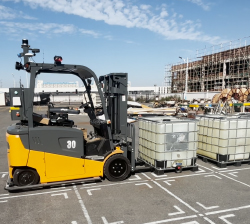
Outdoor Logistics Handling
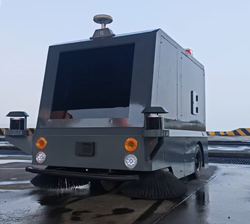
Autonomous Sweeper
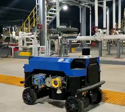
Explosion-Proof Inspection Robot
Features:
1. Fusion Technology: The system tightly-coupled 3D LiDAR–GNSS fusion eliminates localization mode switching and maximizes robustness..
2. Mapping Performance: The combined use of GNSS and LiDAR enables optimized mapping loop closure matching , ensuring no gaps or discontinuities in the generated map.
3. Localization Precision: The solution provides globally consistent localization with no sudden jumps or drift resets. In dynamically obstructed outdoor environments—including certain port scenarios—it maintains ±3 cm positioning accuracy.
4. Environmental Adaptability: The system operates reliably down to –25°C and remains stable even under Beaufort scale 8 coastal winds.Its anti-salt-spray corrosion protection ensures long-term durability in marine environments.
5. Operation Efficiency: Equipped with an intelligent navigation system, it plans optimal routes to avoid collisions and congestion, improving handling efficiency by up to 400% in specific port-cleaning applications.
6. Installation Requirements: To ensure optimal performance, the 3D LiDAR must be mounted over 0.5 m above ground with a horizontal field of view exceeding 270°.The GNSS antenna must be installed above 0.5 m in a fully unobstructed area.
7. Communication & Interfaces: The system supports standard industrial protocols including Ethernet, RS232, RS485, and CAN bus for versatile connectivity with drivers, sensors, and safety components.
8. Safety & Control: Supports comprehensive safety modules including Emergency Stop (E-Stop), Safety Bumpers, and Obstacle-Detection LiDARs to ensure secure autonomous operation.
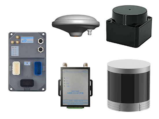
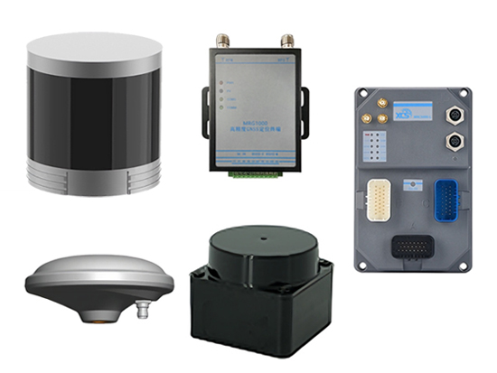
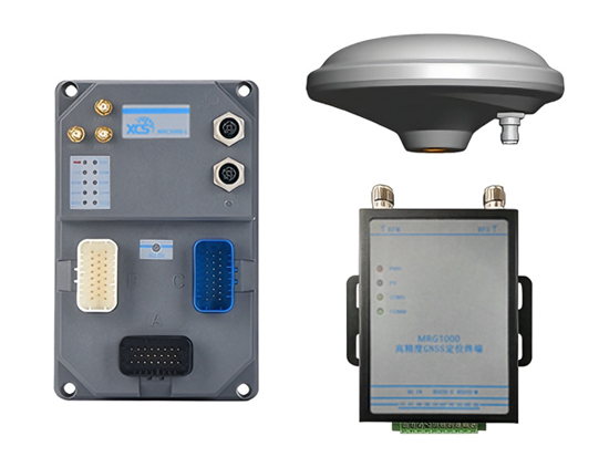
9. Equipment List (3D LiDAR + Self-Built RTK Base Station).
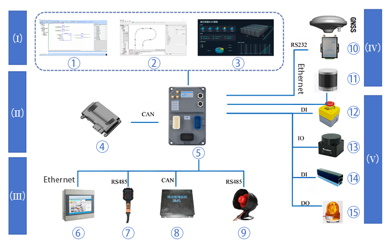
(I) Control System
① Robot Design Software
② Robot Application Software
③ Robot Fleet Dispatching & Monitoring System
(II) Motion Control Bus
④ Chassis Control: Motor Drivers / VCU (Vehicle Control Unit)
⑤ Universal Mobile Robot Controller
(III) Expansion Function Bus
⑥ Touch Screen
⑦ Teach Pendant
⑧ Battery BMS (Battery Management System)
⑨ Voice Annunciator
(IV) High-Precision Positioning Bus
⑩ Positioning Module
⑪ 3D LiDAR
(V) Safety Bus (for Mobile Robots)
⑫ Emergency Stop (E-Stop)
⑬ Obstacle-Detection LiDAR
⑭ Safety Bumper / Contact Safety Edge
⑮ Audio-Visual Alarm
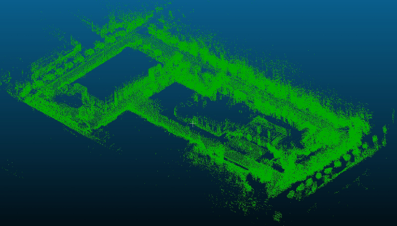
3D LiDAR-GNSS Fused Mapping
Installation Requirements:
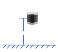
3D LiDAR ground clearance>0.5 m
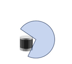
Horizontal scanning coverage of > 270°
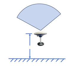
GNSS antenna ground clearance>0.5 m
If you have any question or comment, please contact us without hesitation. We
will reply you as soon as possible.( * is required information)